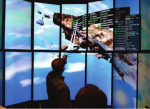
ArtifactVis2 is an immersive analytics to support archaeologist to centralize and analyse their findings of an excavation site. The Iron Age II site in Southern Jordan was used as reference excavation site and data has been divided in four main groups: base maps, artefacts, loci, and architecture.
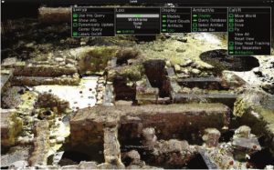
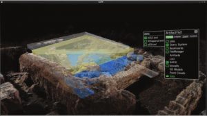
The whole excavation site has been reconstructed through Lidar capture and SfM techniques to obtain a photo-realistic 3d model at real scale. Artefacts and loci are located at their finding location on this map helping archaeologist drawing conclusion by comparing them.
ArtifactVis2 allows user to arrange objects by grabbing them, letting archaeologist organizing their virtual environment as they please. Moreover, annotation is possible through the creation of annotation windows where text input can be saved by using text input through a keyboard or a tablet.