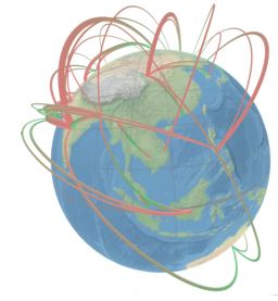
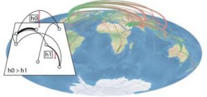
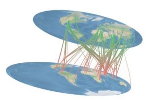
This immersive analytics system allows user to analyze air traffic trajectories over earth map using virtual reality hmd. Multiple representation modalities are availlable. For instance, representing all trajectories on top of a flat earth map, where a color gradient encode the direction of the flow and the height the distance of the trajectory, allowing for better visibility limiting oclusion. A second representation let the user manipulate two 2D flat map with the controllers, one map used for the origin of each trajectories while the second representing the destination. Last, a 3D globe representation is also explored, where the users is free to rotate it to observe the trajectories.